Tuesday, February 13, 2018

Problems of Pedestrians on Roads of Indian Cities


The following points illustrate the problems of pedestrians on roads of Indian cities with some of the related facts and figures.


1.     It is NOT safe to walk on roads in Indian cities – It is not easy, safe or healthy to walk on roads in Indian Cities. Urban planning in the country seems to have failed to accommodate for pedestrian amenities required for a citizen to choose walking as a preferred option to commute. Rapid urbanization and massive industrialization have contributed to taking air pollution in India to alarming levels, which makes walking on roads difficult for citizens. Civic bodies appear to be ineffective in efforts to address the day-to-day problems faced by pedestrians. And, society at large doesn’t seems to be concerned about the very basic privilege of a citizen to walk on the road with dignity and pride. 


On the other hand, Indian roads are extremely polluted. Data available on pollution are alarming. India is ranked amongst nations with highest level of air pollution in a recently published data by International Energy Agency and World Health Organization. The Picture - 1 below illustrates the same. Further, as shown in Picture – 2, India happens to be amongst the nations with highest number of deaths from air pollution. The next picture (Picture - 3 below), shows that ten out of the fifteen most polluted cities of the world are Indian cities (as per 2014 data published by WHO). Most of these cities are not amongst the metro cities or mega cities but are amongst Tier-II cities.


Picture – 1: Nations with Highest & Lowest Pollutions (Reference - https://www.weforum.org/agenda/2017/02/the-best-and-worst-countries-for-air-pollution-and-electricity-use)

Picture – 2: Nations with Most & Least Deaths from Air Pollution (Reference - https://www.weforum.org/agenda/2017/02/the-best-and-worst-countries-for-air-pollution-and-electricity-use)

Picture – 3: Worlds most polluted cities are in India (Reference - http://www.thehawk.in/news/these-are-the-15-most-polluted-cities-in-the-world ; Source – WHO, 2014)


2.     Interestingly, studies suggest Indians are also amongst the nationals having least average-daily-walking-steps (refer Picture - 4) - Despite the fact that most of the parts of the country has got good weather to walk most of the time round the year, we Indians do not walk as much as (most of) other nationals walk.  Stanford University analysis published in the journal Nature, we Indians are officially among the laziest people in the world. The study ranks India at 39 after comparing the walking patterns of 46 countries. The picture below (Picture - 4) is a good visualization on walking pattern of some of the countries across the globe. To an otherwise health conscious urban population, the issues of pedestrian safety and the issue of air pollution may surely be contributing reasons to poor walking figures illustrated in the graph (Picture - 4). This correlation (between conditions for walking on roads and average-daily-walking-steps for any region) may worth investigating by researchers.

Picture - 4: Average Daily Walking Steps across the Globe (Reference - https://www.scoopwhoop.com/indians-are-among-the-laziest-people-in-the-world-because-we-dont-like-to-walk/#.9f42jyzz5 published July 14, 2017; Source – Tim Althoff, Stanford)

3.     Nevertheless, everyday over a fifth of non-agricultural working class walks to their workplace in IndiaOver a fifth of  200 million working Indians (who are neither employed in agriculture nor in household industries) commute to work on foot, followed by commutes by cycle, moped or motorcycle and bus, new data from the Census shows (refer – Picture - 5). More illustration on mode of transportation of working population in megacities is given in the following picture (refer - Picture – 6).

But, in the other picture (Picture – 7), the census data also shows that in India most of the commuter to work place walk less than 5 kilometers (approximately 6,600 steps, assuming 1 kilometer = 1,320 steps). This is far less than 8000 – 10,000 steps of daily activity recommended by most of the reputed agencies related to healthcare (reference - https://www.ncbi.nlm.nih.gov/pmc/articles/PMC3197470/table/T1/ )

Picture – 5: Non-Agriculture Workers Commute to Workplace (Reference - http://www.thehindu.com/data/india-walks-to-work-census/article7874521.ece; Source – Census Data)

Picture – 6: Commuting in India’s Megacities (Reference - http://www.thehindu.com/data/india-walks-to-work-census/article7874521.ece; Source – Census Data)

Picture – 7: Mode wise distance wise commute to work place in India (Reference - http://www.india.uitp.org/articles/mobility-in-rural-india; Source - Census data)


Anyhow, it is a known fact that in comparison to relatively better economies (China or Western Europe), there exist a significant gender disparity in India across a spectrum of development indicators (Picture - 8).

Picture – 8: Gender Disparity in India (Reference: http://indianexpress.com/article/explained/how-india-ranks-on-gender-parity-and-why/ ; Source: Mckinsey Global Institute Report, 2015)

Therefore, there is a likelihood that observed gender disparity in walking pattern could be just reflection of larger gender disparity prevailing in society. Many studies suggests that vulnerability of women pedestrian in developing countries (like India) have close link with existing socio-cultural conditions. Thus, in addition to general factors limiting women pedestrian like road congestion, exposure to crowding, air and noise pollution, inaccessibility, the other risks are violence, crime and sexual harassment (Seedat, MacKenzie, & Mohan, 2006). 

Nevertheless, it is important for countries across the globe to work towards gender equality. It may be noted that narrowing the gender gap at work could add $28tn to the global economy by 2025 (according to a research by Mckinsey conducted in 2015).

It may sound convincing that the causes of observed gender disparity in data of pedestrians on Indian roads be rooted on existing socio-cultural conditions. So, efforts should be made to address the causes and effects may automatically start improving. But, there could also be merit in the converse argument. Thus, the possibility of bringing changes to socio-cultural conditions (for gender equality) by making Indian roads much safer for women could also be possible, at least to some extent. May be, because, there could be link between socio-cultural norms and insecure environment for the issues like gender disparity. Researches in this direction at different levels and under diverse conditions may be helpful in conclusive deducing any associated link and its characteristics.


Roads 
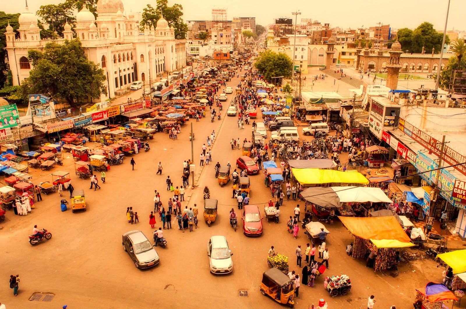
are amongst the important urban Public Spaces in Indian cities. Diversity and dynamism on Indian roads portray picture of a society full of life and vigor. However, these roads also reflect that this public space (roads) is not being put to use for the larger benefit of all the citizens. The facilities available on the roads do not seem to be doing justice towards pedestrians (who are mostly assumed to represent poorer population).


Now, in the following couple of points, an attempt is made to briefly sum up some of the reasons usually cited for problems of pedestrians on Indian roads:-

1.     Pedestrian is lost in the era of Rapid Urbanization – In recent past, urbanization has taken place at unprecedented pace in India. This has not given the governing agencies time to develop required facilities in a planned manner. The daunting challenge of accelerated pace of urban transformation faced by India can be understood with the available census data on rate of urbanization and on rate of motorization (Picture – 9 and Picture – 10). 

Picture – 9: Rapid Urbanization; (Reference: http://iihs.co.in/knowledge-gateway/wp-content/uploads/2015/07/RF-Working-Paper-Transport_edited_09062015_Final_reduced-size.pdf; Source: Census Data for 2011)

Picture - 10: Growth of Registered Vehicles in India (Reference: http://iihs.co.in/knowledge-gateway/wp-content/uploads/2015/07/RF-Working-Paper-Transport_edited_09062015_Final_reduced-size.pdf; Source: Census Data for 2011)

Workers moving to urban clusters for better job opportunities is an age old story. Cities have always been thought as engine of economic growth and prosperity. Traditional view of linking urbanization to job creation and to economic development was dominant in past decades in India and therefore, it was not possible to restrict, to resist or to control (with the intent of systematically organizing) the pace of urbanization in this poor country with consistently increasing population.

In view of exploding expansion of cities and rate of motorization, appropriate planning of road facilities, which may do justice with pedestrians could not be conceived, planned and executed. Eventually, the concerns of pedestrians consistently got ignored to the extent that the roads of Indian cities became extremely unsafe for them. 

But, new researches indicate that building urban infrastructure, enacting directed policies, encouraging management of knowledge capital and promoting entrepreneurship could make the real difference for maximizing economic advantage from urbanization. There is no simple linear relationship between urbanization and economic growth, or between city size and productivity. The potential of urbanization to promote growth is likely to depend on how conducive the infrastructure and institutional settings are. Removing barriers to rural–urban mobility may enable economic growth, but the benefits will be much larger with supportive policies, markets and infrastructure investments. Cities should use realistic population projections as the basis for investing in public infrastructure and implementing supportive land policies. Governments should seek out ways of enabling forms of urbanization that contribute to growth, poverty reduction and environmental sustainability, rather than encouraging (or discouraging) urbanization per se. Thus, it is suggested that, to capitalize on the benefits of urbanization (that has happened) so far, a strategic planning with due considerations to inclusive development and to a just and fair distribution of scarce urban public spaces will be critical. This can not exclude suitable infrastructure with enabling technology to address the issues of pedestrians.

2.     Challenging Dynamics of Urban Infrastructure Development 


In the days of rapid urbanization, urban public space is a scarce resource and it is important to plan its utilization for inclusive development of a city. Roads are the most important urban public space in developing countries like India. Ensuring access to roads to different mode of transportation in such a way that pedestrian can walk safely and more importantly with dignity and pride should be utmost priority of urban planners. This is possible only when planners understand dynamics of road traffic and public behavior on roads to much greater depth. These days advanced systems installed for surveillance (in public places and private places) do produce data for analysis and interpretation of planners. Researches on the related topics may also be promoted for understanding different minute aspects of roads in different areas during different times. 

In many occasions, even with making a choice of best possible solutions, it becomes difficult for roads to accommodate pedestrians due to other dominant mode of transportation and / or due to encroachments of roadside footpath; in such situations, alternate access to pedestrians through pedestrian-walk-ways parallel to roads in the same vicinity may be considered.  

It is widely believed amongst the development sector experts that both public and private agencies entrusted to urban planning and urban infrastructure development in developing countries have temptation to replicate successful urban plans and planning methodologies from advanced countries. In the process, as many people suggest, they often miss basic local needs. Not addressing to pedestrian issues in urban planning in Indian cities is cited as one such case.

Many times governing agencies and administrative bodies responsible for urban development also could not give adequate attention towards urban planning. Some people believe that these organizations function in a work culture which is highly hierarchal, strictly driven from top and very much focused on just getting urban development projects executed and generating output (rather than focused on ensuring objectives are met and impactful outcomes is achieved). Such organizations limit collaborations both within and outside the organization. A few others suggest that political compulsions of democratic governments to do things for public good in chunks of short-term spoils the larger vision of long term planning for urban development.

Another group of people point out that critical civil issues of interest to general public and to larger societal benefits do not get due attention in the prevailing political process in India. Developing consensus among influential political groups or dominant communities to converge for a solution on general issues is usually found to be a difficult task. Mostly, political groups and communities have many issues to address, which relates to the specific interests to these entities. Thus, it takes time and effort to voice civil issues of general public. Problems of pedestrian is considered to be one such issue. 


References:

  • https://www.researchgate.net/publication/281089650_Pedestrian_Safety_and_the_Built_Environment_A_Review_of_the_Risk_Factors
  • https://www.researchgate.net/publication/223853809_The_phenomenology_of_being_a_female_pedestrian_in_an_African_and_an_Asian_city_A_qualitative_investigation
  • http://thecityfix.com/blog/where-are-footpaths-case-protecting-pedestrian-rights-india-himadri-das-sahana-goswami
  • http://www.livemint.com/Science/6rKWVcHEGH6IdN7ghWkLlN/What-is-making-urban-young-India-unhealthy.html
  • http://thecityfix.com/blog/out-of-the-drivers-seat-the-safety-impact-of-auto-rickshaws-on-pedestrians-and-cyclists/
  • http://www.censusindia.gov.in/2011census/B-series/B_28.html
  • http://iihs.co.in/knowledge-gateway/wp-content/uploads/2015/07/RF-Working-Paper-Transport_edited_09062015_Final_reduced-size.pdf 
  • https://www.mahindraworldcity.com/wp-content/uploads/2017/10/Livability-Quotient.pdf
  • http://www.telegraph.co.uk/travel/maps-and-graphics/Mapped-The-worlds-most-urbanised-countries/
  • http://censusindia.gov.in/2011-prov-results/paper2/data_files/India2/1.%20Data%20Highlight.pdf
  • http://nbr.org/downloads/pdfs/eta/PES_2016_working_paper_shastry_pai.pdf
  • https://paycheck.in/main/career-tips/research-publication/how-much-time-do-indians-spend-on-commuting-to-work-place 
  • https://globalnews.ca/news/3887057/toronto-commute-long-canada/
  • https://www.theguardian.com/news/datablog/interactive/2013/feb/01/cycle-drive-work-map-census-2011
  • http://www.livemint.com/Opinion/jyFgs0yWYfgFSukwv8NcyH/Is-access-to-transport-slowing-participation-of-women-in-Ind.html
  • https://www.researchgate.net/profile/Dinesh_Mohan2
  • http://journals.sagepub.com/doi/full/10.1177/0956247813490908
  • https://www.researchgate.net/publication/235962518_Urbanisation_and_Economic_Development_in_India

Wednesday, September 20, 2017

Some Points to Consider for Planning Green Open Spaces in India


In recent times, governments in India are trying to develop Green Open Spaces. This blog-post is an attempt to collate some points, which may be helpful for professionals involved with planning for Green Open Spaces for Indian Cities.

1.     Definition: Green Open Space


School of Global, Urban and Social Studies RMIT University prepared a Report for Australian Government Department of Environment in October 2014 titled "Planning for green open space in urbanising landscapes".

In this report, the team of experts have defined green open space as all publicly owned land that is set aside primarily for recreation, sports, nature conservation, passive outdoor enjoyment and public gatherings. This includes public parks, gardens, reserves, publicly owned forecourts and squares. 

To arrive at this definition, a lot of literature review was done by the experts. Therefore in this article, we will stick to this definition. Public Open Space are found to be synonymous with this definition of Green Open Space. 

2.     Points to consider for Planning Green Open Spaces (GOS)


a)      Try to Maximize Healthcare Benefits:


One suggested way to obtain both physical and mental health improvements is through ‘green exercise’ – taking part in physical activities ‘whilst at the same time being directly exposed to nature’. Increasing access to high-quality public spaces where green exercise can take place produces substantial public health benefits and so reduces healthcare costs.

Following are most popular healthcare considerations for designing of Green Open Spaces in India.

a.      Provide Means to Encourage Physical Activity – In general, it is observed that in urbanized world people are NOT doing enough physical activities. The World Health Organization has already identified physical inactivity as the fourth biggest killer on the planet, ahead of obesity. Experts are now describing sitting as 'the new smoking', a ticking time bomb of ill health just waiting to explode. Studies suggest that access to public open spaces as one of the factors contributing to encourage people for doing physical activity. One such study found that people who use public open spaces are three times more likely to achieve recommended levels of physical activity than those who do not use the spaces. Users and potential users prefer nearby, attractive, and larger parks and open spaces (Wolf, 2008).

b.      Provide Platform to Encourage Sunlight Exposure - It may be noted that 60 – 70% of Indians are deficient in Vitamin-D. Exposure to sunlight during early hours of the day or during afternoon could significantly improve daily intake of vitamin D. Easy access to Green Open Spaces may surely encourage health conscious people to get required exposure to sunlight.

b)     Try to contribute to Reduction in Air-Pollution:

a.      The Problem of Air Pollution in IndiaAir pollution in India has been rising at alarming rates. A closer analysis of the data, obtained through RTI and previous studies on air pollution, pinpoint to continued use of fossil fuels as the main culprit for the dangerous rise in the level of pollutants in the air across the country (the Greenpeace India Report).

India is one of the most polluted countries in the world and air pollution is a major threat to health. But, the AQLI (Air Quality Life Index) reveals that if India reduced its air pollution to comply with the WHO’s air quality standard, its people could live about 4 years longer on average, or a combined more than 4.7 billion life years. If the country reduced pollution to comply with its national standards, its people could live more than 1 year longer on average, or a combined more than 1.6 billion life years. The details are shown in Picture-1. (Reference - Energy Policy Institute at The University of Chicago AQLI, Spotlight – India)

Air pollution has both acute and chronic effects on human health, affecting a number of different systems and organs. It ranges from minor upper respiratory irritation to chronic respiratory and heart disease, lung cancer, acute respiratory infections in children and chronic bronchitis in adults, aggravating pre-existing heart and lung disease, or asthmatic attacks. In addition, short- and long-term exposures have also been linked with premature mortality and reduced life expectancy. (Marilena Kampa & Elias Castanas, Laboratory of Experimental Endocrinology, University of Crete, School of Medicine, P.O. Box 2208, Heraklion, 71003, Greece)

Effect of polluted environment is not limited to diseases. Some recent researches are also indicating that higher pollution level leads to a higher crime rate.

Picture – 1: Reference - https://aqli.epic.uchicago.edu/wp-content/uploads/2017/09/AQLI_1Pager_India_Final.pdf , Energy Policy Institute at The University of Chicago

b.      Plan Plantation in Green Open Spaces with intent to Reduce Air-PollutionPlants can be used as both bio-monitors and bio-mitigators in urban an industrial environments to indicate the environmental quality and to ameliorate pollution level in a locality. Certain plants species (Holoptelea integrifolia L., Mangifera indica L., Pongamia pinnata (L.) Pierre, Dalbergia sissoo Roxb.) can be successfully grown in an area for monitoring and control of air pollution effectively besides acting as shade tree and being a source of food for animals and birds. (Kapoor CS, Chittora AK (2016) Efficient Control of Air Pollution through Plants a Cost Effective Alternatives). Thus, if Green Open Spaces are being planned next to a polluted busy road, the planners may consider fencing the open space with suitable trees. 


c.      Other Considerations for minimizing Air-Pollution – Planners may try various possibilities for limiting air-pollution. Some considerations could be:-

                                                              i.     Selection of location of Green Open Spaces (GOS) – GOS must be located in relatively less polluted area. At the same time the location should be easily accessible to the beneficiaries to reduce any incremental pollution due to conveyance of beneficiaries to the GOS.

                                                     ii.     Parking facilities adjoining GOS must be provisioned to avoid traffic congestion around the GOS due to haphazard parking. Traffic congestion adds to the existing pollution, wastes time and fuel of public.

                                                         iii.     Technology enablement of GOS to keep track of pollution levels all throughout the year could be useful for taking decisions on further course of action on changes to the GOS with introducing new things. It has been observed time and again that introducing measurement is critical for quality improvement and efficient management.


c)     Keep in Mind Bio-Diversity Protection:

a.      Encourage Protection of Bio-Diversity in Urban Areas - A network of parks and open spaces that include protected natural lands, ecological reserves, wetlands, and other green areas is critical to providing healthy habitats for humans, wildlife and plants in these densely built places. Natural landscapes are vital to preserving regional ecosystems amid growing cities.


Planners of Green Open Spaces may need to first understand city’s ecological network and to identify important flora and fauna. Thereafter, a comprehensive plan synchronized with city’s ecological network (connecting other city owned lands like (say) urban forests, street networks (greenways on footpath or between road dividers) or even (wherever relevant) private owned large open spaces) may be prepared.

In India, it is less likely to get data on city’s ecological network for most of the cities. The help of academic institutions and student communities may be taken by encouraging more studies and more research in this area. A well planned and adequately funded scheme for researchers to carry on research in fields related to Bio-Diversity may also be planned to support the schemes for GOS. Engaging experts from other countries for consulting in this field, which is getting more and more relevant may also be considered.

d)      Remember the SUCCESS of Green Open Space is NOT Possible without Engaging Intended Beneficiaries and Public at Large:

It is now a generally accepted fact that making public to participate in design of GOS yields better results. North Carolina is a state in the southeastern region of the United States. This state has adopted a Public Participation Policy for Park Planning on May 14, 2014.

Thus, in whatsoever ways possible, an attempt to engage public in decisions related to planning and design of GOS may be made. Conducting surveys (online or offline) could be one of the ways to get public opinion. Holding meeting with representative groups could be another possible way. Many other possibilities could be explored to engage public in the vicinity of proposed GOS.

Further, engaging target beneficiaries to the GOS and monitor whether intended benefits are getting delivered is required. This is possible through coordinated efforts for encouraging people to avail benefits from Green Open Spaces. Let us take example of associating citizens for healthcare benefits. Urban Planners may understand the demographic details and healthcare needs of target beneficiary groups while designing Green Open Spaces. Provision for suitable facilities keeping in view target population, locality, location, weather, culture and general public psychology could be incorporated. The administrative authority (may be - Urban Local Body or Local Administration), which is responsible to maintain Green Open Space may try innovative ways to utilize the facilities provisioned with attractive offerings to drive the beneficiaries for availing healthcare benefits.

I am neither an urban planner nor an architect but may try to come up with an fictitious example to illustrate how co-ordination of different agencies is important for meeting intended objectives of a plan. For example older people are at higher risk of vitamin D deficiency. Therefore, the objective of a Public Garden could to bring senior citizens residing nearby to a place where they may get exposure to sunlight during morning and evening hours (exposure to sunlight enhances Vitamin D in humans). Keeping this in view, Green Open Space Planners may suggest a restaurant with glass ceiling, having very large glass windows (on walls facing the East and the West) located at the central region of a Public Garden. The coating on the glasses could be changeable in accordance with seasons (allowing more perforation for sunlight during winter and like-wise). This will make a perfect place for people to hang around in the garden, eat something in the restaurant and while dining, get exposure to mild appropriately filtered sunlight during day time. This restaurant may be tendered to a vendor for operation. The administrators of public gardens may use funds available for healthcare initiatives (or (say) funds available for increasing public participation in public facilities provisioned by the state) to encourage the management of restaurant to come up with innovative ideas to attract senior citizens to reach hotel during morning and afternoon time and get rewarded in proportion to senior citizen the restaurant attracts. Restaurant management will try different options. (May be they take into cognizance that) Green Tea has been found to be helpful in improved functioning during old age. Therefore, restaurant management may offer free of cost green tea (subsidized by local administration funding it receives) to senior citizens reaching restaurant during pre-defined time in the morning and evening. Restaurant management may also propose attractive offers like (say) provision to play popular old tunes on demand by senior citizens during those hours on the music system at restaurant. Restaurant may also invite pathology lab representatives to restaurant to help senior citizens monitor their Vitamin D levels. This pathology test may be sponsored by some agency (say an NGO working for healthcare of senior citizens) for those people, who may not be able to afford. This pathology test data may determine one of the outcome of the Public Garden.

In India, many times, public offices do not have adequate infrastructure, adequate fund or adequate institutional framework to track and evaluate GOS projects right from need to objectives to outputs to outcome through data driven approach (nor are the real problems faced by offices as easy as described in fictitious narration above). But, all these should not deter planners to go for preparing plans with suitable metrics and required project management data. So that, need for data which are most critical to the success of project may get noticed by the stakeholders and by other interested groups. It is very much likely that with accelerated technology diffusion, with institutionalization of e-Governance initiatives in public offices and with efforts of concerned groups, the situation will improve in not so far future.

3.     References


1.      Urban planning and the importance of green space in cities to human and environmental health

2.      Community Participation Strategies in Planning for Urban Parks

3.      Planning for Parks, Recreation, and Open Space in Your Community

Sunday, August 13, 2017

What Can Rainfall Data of Karnataka Reveal to a Development Sector Professional?


Summary:-

The article begins with analysis of yearly rainfall data of Karnataka. It is observed that Coastal Karnataka gets exceptionally higher rainfall. The suggested reason for higher rains (in Coastal Karnataka) available in literature has been listed. Drawing parallels with rainfall data, it is observed that number of wet days per year and percent of cloud cover during rainy season are also higher for Coastal Karnataka. This region is found to be comparatively rich in forest cover with respect to other parts of the state. Further, an attempt is made to analyze drought-prone areas of Karnataka and pattern of recent drought in 2015. It has been observed that most parts of Coastal Karnataka does not fall under drought-prone area and are least affected during recent drought. Possible reasons for drought other than rainfall has also been briefly touched upon.

In the end, some points are illustrated with facts and figures for development planners of the state of Karnataka to take into consideration while designing development schemes under following headings:-

1)     Possible considerations for Planning of Water Management
a)     PPP Model for Effective Execution
b)     Promotion of Rain Water Harvesting (RWH)    
c)     Use of Adequate and Cost-Effective Technology for Water Management
d)     Further Exploration of Innovative Ways

2)     A few Critical Challenges for Planning of Forestation Initiatives
a)     Forestation in regions with Depleting Ground Water
b)     Strategic Forestation in Coastal Regions to Curb Coastal Erosion

3)     Considerations to Vulnerability of Migrants (Migrating due to Natural Calamities)

 - - - - - - -


Point Wise Illustrations:-

A.    Historically Coastal Karnataka Receives Significantly More Rainfall Than Rest of Karnataka

a.      Karnataka Yearly Rainfall Pattern - Average rainfall received by Karnataka suggests that Karnataka gets good amount of rain during four months of rainy season – JUN to SEP. This is shown in the picture below (data is taken from reference – a)


            (Picture-1: Distribution of Rainfall Across the Year in Karnataka)


b.     The Six Districts Get Significantly More Rainfall - District wise average annual rainfall across districts of Karnataka suggest that six adjoining districts of the state get exceptionally high rainfall (Please refer to following point for list of these districts). The yearly average rainfall of these six districts for last 10 years is 289.1 CM in comparison to state average of 115.2 CM per year. Out of these six districts, the yearly average of top four districts receiving maximum rainfall is 340.5 CM, which is almost thrice the state average (reference – a).


(Picture-2: Map of Karnataka – reference d)

c.      These Six Districts are located in Coastal Region of the state (Karnataka) - These districts are located in coastal belt and are listed as under (in order of highest to lowest yearly rainfall (average) – (refer Picture-2 and Picture-3):-
                                                    i.      Udupi – Average Rainfall of 418.0 CM per Year
                                                  ii.      D.Kannada – Average Rainfall of 391.2 CM per Year
                                                iii.      U.Kannada – Average Rainfall of 288.6 CM per Year
                                                iv.      Kodagu – Average Rainfall of 264.4 CM per Year
                                                  v.      Chickmagalur – Average Rainfall of 190.5 CM per Year
                                                vi.      Shimoga – Average Rainfall of 182.0 CM per Year
The next highest rainfall is received by Hassan district which is a distant 98.9 CM per Year (nearly half of what Shimoga receives) - (reference – a)


(Picture-3: District Wise Rainfall for State of Karnataka – compiled from reference - a)

B.    Research on Possible Reasons for Heavy Rainfall Received by Coastal Region of Karnataka – (reference – b)

a.      Ms Sayli A. Tawde is presently a PhD student in the Centre for Atmospheric & Ocean Sciences, Indian Institute of Science, Bangalore, has carried out studies on Mansoon Rainfall on Western Ghats of Karnataka as a part of her M. Tech project under the supervision of Ms. Charu Singh, a scientist at Marine and Atmospheric Sciences Department, Indian Institute of Remote Sensing, ISRO, Dehradun, Uttarakhand. The studies highlights are several possible reasons for excessive rainfall received in Western Ghats of Karnataka. These are:-

                                                    i.     First, the mountain topography in Karnataka is broader than the narrow topography of the Ghats in Maharashtra. Due to the greater width of the mountains, the rain bearing winds have to necessarily travel a longer distance and have more time for the drops to coalesce and precipitate as rainfall, resulting in higher rainfall. In contrast, the narrow width of the Ghats in Maharashtra allows the rain-bearing wind to cross over to the leeward side rapidly before precipitation can occur. As for Kerala, the Ghats there are in the form of isolated mountains, where the rain-bearing winds can easily cross over to the leeward side through the gaps in between without precipitation occurring.

                                                  ii.     Second, the slope of the mountain has a direct bearing on the possibility of precipitation. This is borne out by the Ghats of Karnataka where the mountains are gently sloping, compared to the steep slopes of the Ghats in Maharashtra and Kerala. The air parcel will retain its energy and speed for a longer time when the slope is gradual. This will provide sufficient vertical motion to cloud droplets to grow by collision–coalescence process and hence form precipitation.

                                                iii.     Third, the gentle slope provides a greater area for sunlight absorption and heating leading to greater convection when compared with an abrupt slope i.e. less Ghat area such as that of the Maharashtra and Kerala Ghats.

                                                iv.     Fourth, the continuous mountain range presents a greater barrier to rain-bearing winds than a range comprising isolated mountains with gaps in between where the winds can easily pass to the leeward side. Unlike in the case of Kerala, the Ghats in Maharashtra and Karnataka are continuous.

C.    Historically, The Coastal Region of Karnataka also has greater Percentage of Cloud Cover & more Number of Wet Days in a Year – (reference – e)

a.     Water Portal of MET has collated district wise rainfall related data for more than one hundred years. (http://www.indiawaterportal.org/met_data/)

b.     The data for number of Wet Days and percentage Cloud Cover are not available for all the six districts that have been found to be receiving significantly above average rainfall in Karnataka. However, data from year 1901 to 2002 for Chikmagalur, Kodagu and Shimoga suggests that wet day frequency are quite high during rainy season and for three months during the year wet days are more than 15 days a month. Similarly, Cloud Cover in these three districts is found to be around or above 50% for four to five months during a year.

D.    However, Karnataka has vast area which has been termed Drought Prone (Mostly falling in Non-Coastal Areas of the State) – (reference – j)

a.      The CWC after detailed study has identified 14 districts in Karnataka as ‘droughtprone’. According to this study an area of 1,52,163 sq.kms. which represents 80 per cent of the total area of the State is drought-prone.

b.     Area of Bijapur, Dharwad, Hubli and Bagalkot are always the most affected when there is a drought in northern part of Karnataka.

c.      After studying decades of rainfall pattern and other factors the drought-prone districts of Karnataka are given in the table below (reference - shodhganga.inflibnet.ac.in)

(Picture-4: Drought-Prone Districts of Karnataka)

E.     Consistent Deficiency of Rainfall and Recent Drought in Karnataka (2015)

a.      Meteorological drought is classified based on rainfall deficiency w.r.t. long term average – 25% or less is normal, 26-50% is moderate and more than 50% is severe.

b.     Karnataka is witnessing drought for the third successive year; rainfall has been deficient since 2012-13. 

c.      Drought in 2015 – The drought in 2015 affected 135 Talukas in 27 districts of Karnataka. In reference to the map below, the pattern suggests that the coastal region of Karnataka are the least affected.


(Picture – 5: Drought Affected Talukas for Drought in 2015 – reference f)

d.     It has been reported that following issues have surfaced as a result of recent droughts due to deficiency of rainfall in Karnataka (Reference - g) :-
                                                    i.     Drinking Water Crisis
                                                  ii.     Water levels in reservoirs are reaching at alarming levels
                                                iii.     Fodder Shortage
                                                iv.     Unemployment and Migration
                                                  v.     Power crisis due to unreliable hydropower 

e.      Other than deficiency of rainfall, possible reasons for the severe drought are as under (Reference - i) :-

                                                    i.     Extinction of Water Bodies – Water bodies (natural or man-made) are regarded as direct or indirect life supporting system for millions of living beings, significant source of water and moderate the hydrological extreme events like (say) drought. In the state of Karnataka about 35% of wetland are threatened due to sedimentation, 43% are subject to encroachments and 22% are due to rampant growth of exotic weeds.  

                                                  ii.     Depleting Ground Water - Consistently depleting groundwater due to increase in population and rapid urbanization has been aggravated due to farmers switching from traditional crops to cash crops (like sugarcane and cotton).

                                                iii.     Failure of Rainwater Harvesting – Efforts to engage public with Rainwater Harvesting by bringing suitable legal framework and by generating awareness did not seem to have succeeded. The suggested causes are:-
1.     inadequate financial assistance,
2.     long winded procedures and
3.     poor maintenance of structures once they are built

                                                iv.     Depleting Forest Cover – "Among the six states (1920-2013), historical loss of forest area was very high in Western Ghats of Kerala with forest cover loss of 62.7 percent of area, followed by 34.9 percent in Gujarat, 27.1 percent in Karnataka, 26.3 percent in Goa, 21.6 percent in Maharashtra and 15.2 percent in Tamil Nadu," reveals the research paper which has been published in the "Journal of Earth System Science" of the Indian Academy of Sciences.

F.     Points Worth Considering for Development Planners

a.      Consideration for Planning of Water Management – Some experts believe that more sensible water management is required for effectively working towards water crisis.  

                                                    i.     PPP Model for Effective Execution - Despite all inherent problems in implementation of PPP projects under Indian conditions, one must accept that this is one of the most effective ways with a great potential to bring difference to infrastructural development. There has been many success stories too and there is a prospect to learn from past experiences and revive PPP implementation in India. (reference – l)

In the recent past, Kerala chose to respond to drought in 2013 with PPP arrangement. Learnings from such initiatives can be used for better implementation of new PPP implementations.

Water bodies can be rejuvenated under PPP in drought prone areas of Karnataka. Tanks and lakes play an important role in helping irrigation as well as recharging ground water in the surrounding areas. A detailed feasibility study on use of PPP for rejuvenation of lakes has been done by Infrastructure Development Corporation (Karnataka) Limited. In this study, it has been suggested that protests against PPP for rejuvenation of lakes is due to apprehensions issues related to commercialization of lakes. However, conservation of lakes under private participation could be undertaken by framing a suitable guidelines and policies for private participation which is not purely commercial in nature and the guidelines should provide for environmental protection, ecological sensitivity issues, abatement of pollution and more so ever conservation of lakes for the public purpose by the private parties. Further, it has been recommended that development of Lake Fronts be included within the scope of the project to make such projects a viable business proposition for private partners.

                                                  ii.     Promotion of Rain Water Harvesting (RWH) – In brief is defined as the process of concentrating rainfall as runoff from the larger area for use of smaller target area. Even though, implementation of RWH in India has been full of challenges, it may be noted that this is one of the established strategies for reducing pressure on water demand (usually in regions with scarce supply of water with reasonably good rain). Tamil Nadu is hailed for successful implementation of RWH initiative through persistent efforts over a decade. It is believed that Public Participation was critical factor for success of RWH. Door to Door campaign on RWH was done for long period of time with active participation of SHGs (Self Help Groups) and NGOs (Non-Government Organizations) to sensitize huge population with wide diversity.   

One of the most important underlying values in rainwater harvesting is that it is a benign technology (Bachelor et al. 2002) and cannot create undesirable consequences. Water harvesting initiatives are driven by firm beliefs and assumptions, some of which are:

1.     that there is a huge amount of monsoon flow, which remains un-captured and eventually ends up in the natural sinks
2.     that local water needs are too small and as such exogenous water is not needed;
3.     that local water harvesting systems are always small and, therefore, are cost-effective;
4.     since the economic, social and environmental values of water are very high in regions hit by water shortages, water harvesting interventions are viable, supported by the assumption that cost- effective alternatives that can bring in the same amount of water, do not exist;
5.     incremental structures lead to incremental benefits; and
6.     being small with low water storage and diversion capacities, they do not pose negative consequences for downstream uses.

In relation to Rain Water Harvesting, recent studies by The Institute for Social and Economic Change, Bangalore insists on Awareness Creation Initiatives and on Strengthening the Process of Implementation for successful implementation of RWH.

However, a group of experts are totally averse to the idea of RWH and they do not consider Water Harvesting or Artificial Recharge in Naturally Water-Scarce Regions of India an economically viable option. The apprehensions raised by such experts must also be taken into account while designing a program on RWH. 

Following points indicate that promotion of RWH in Karnataka may be preferred in Coastal and Southern regions for optimal gains (however, to conclude on this indicative argument or an initial idea, an expert opinion from recognized body must be taken with due consideration to numerous other aspects).  

1.     The pattern of rainfall in Coastal Karnataka (high) and North of Karnataka (low). Regions with lower mean annual rainfall experience higher variability and vise versa (Pisharoty 1990). Hence, in regions with lower mean annual rainfalls, rainwater harvesting as a dependable source of water is likely to be low. Further, runoff harvesting, rainfall has to exceed a threshold to generate runoff. Moreover, smaller magnitude of rainfall usually means fewer rainy days, which also means longer dry spells and thus greater losses from evaporation for the same region. (“Rainwater Harvesting in the Water-scarce Regions of India: Potential and Pitfalls”, M. D. Kumar, A. Patel and O.P. Singh)

2.     The picture below taken from "Rainwater Harvesting in the Water-scarce Regions of India: Potential and Pitfalls" taken from paper by M. D. Kumar, A. Patel and O.P. Singh suggests that Northern Karnataka has greater annual evaporation rates in comparison coastal Karnataka (least annual evaporation in the state)

                                      
(Picture-6: Annual Evaporation Rate)
High evaporation during the rainy season means losses from surface storage structures. It also means a faster rate of soil moisture depletion through both evaporation from barren soils and evapotranspiration, which increase the rate and quantum of soil infiltration. This reduces the generation potential of runoff. Thus, low evaporation is favorable for RWH.

                                                iii.     Use of Adequate and Cost-Effective Technology for Water Management – Incremental adaption of efficient and effective technology for Water Management may result in facilitating better utilization of water. Systematic integration of advanced hydrologic monitoring systems, data analytic systems and other similar systems have capability to improve overall management of water resources.

                                                iv.     Further Exploration of Innovative Ways – Exploration of other possibilities for efficient Water Management be conducted on regular basis. A couple of the recently suggested explorations by experts and planners are a) National Water Development Agency (NWDA) working for strategic interlinking of rivers of the country and b) Supplemental Irrigation is another option suggested by experts. 


Recently, Government of India has come up with the Compensatory Afforestation Fund bill, 2015 that seeks to establish setting up of a National Compensatory Afforestation Fund and also a State Compensatory Afforestation Fund. Therefore, in near future a focused efforts towards Afforestation is expected. And as stated above, in the period 1920 – 2013, Karnataka has lost 27.1 percent of its forest cover. Therefore, afforestation will be on priority (for the state).

The following Forest Cover map taken from Forest Survey of India again suggests that coastal Karnataka has comparatively rich forest cover.


(Picture-7: Forest Cover in Karnataka)

A few of the challenges for planners for Forestation Initiative are as under:-

i.       Forestation in regions with Depleting Ground Water - One of the challenge will be forestation efforts in those part of Karnataka, which are drought-prone and which have depleting ground water. Forestation (Afforestation or Reforestation) will have risk of further depletion of ground water. Technical approaches—such as water diversion, artificial groundwater recharge and efficient irrigation—have failed to balance regional groundwater budgets. They need to be complemented by more comprehensive strategies that are adapted to the specific social, economic, political and environmental settings of each region. This needs inclusive and comprehensive efforts especially in the above mentioned drought-prone regions of Karnataka.

ii. Strategic Forestation in Coastal Regions to Curb Coastal Erosion
Coastal erosion is common phrase referring to the loss of subaerial landmass into a sea or lake due to natural processes such as waves, winds and tides, or even due to human interference.
In Karnataka, about 50% of area under coastal zone is subjected to moderate soil erosion and 6% of the area to severe soil erosion.
Synchronizing forestation with efforts to curb coastal erosion will need detailed survey and strategic site selection. Thus, there will be good possibility that forestation in coastal regions may be support efforts to curb Coastal Erosion. Coastal erosion and accretion are natural processes; however, they may become a problem when exacerbated by human activities or natural disasters. They are widespread in the coastal zone of Asia and other countries in the Indian Ocean owing to a combination of various natural forces, population growth and unmanaged economic development along the coast, within river catchments and offshore.


A.    There is evidence that they provide some coastal protection and their clearance has increased the vulnerability of coasts to erosion. Based on scientific findings, the presence of vegetation in coastal areas will improve slope stability, consolidate sediment and diminish the amount of wave energy moving onshore, therefore protecting the shoreline from erosion.
B.    Increased interest in soft options (in this case the use of coastal forest and trees) for coastal protection is becoming predominant and is in line with advanced knowledge on coastal processes and the natural protective function of the coastal system. This is because hard options are mostly satisfactory in the short term, while soft options are effective in medium to long-term perspectives (five to ten years).
C.    A combination of hard and soft solutions is sometimes necessary to improve the efficiency of the options and to provide an environmentally and economically acceptable coastal protection system.

c.      Considerations to Vulnerability of Migrants (Migrating due to Natural Calamities) – Understanding patterns and reasons of migration is helpful for development planners not only in estimation of future population for distribution of resources but also to understand many inter-related socio-economic aspects associated with migration. In the following data analysis, reasons for migration data are based on the concept of place of last residence and it useful to understand the motivational factors behind movement of people. Some important findings on analysis of 2001 census data is as under:-

1.     About 30.62 percent of the total population of the state is considered as migrants in 2001 census.

2.     Employment and movement because of the displacements of families have been major cause of movement among male migrants; marriage and displacement of families were the most important reasons for female migration.

3.     The proportion of migrants moved due to employment related reasons, increases with the increasing distance. Where as proportion of migrants moving due to marriage decline remarkably with the distance.

4.     The highest proportion of in-migrant population was found in the district of Bangalore whereas Kodagu has the lowest in the period from 1971 to 2001.

5.     The percentage of total migrants to total population in Karnataka from 1971 to 2001 has been slightly higher than in India as a whole, percentage of male migrants also is much higher than in India, but female migrants are fewer in Karnataka compared to India.


(Picture-8: District-Wise In-Migration in Karnataka – 2001 Census Data, Reference - q)

6.     The general pattern that can be observed in the above picture suggests preference of coastal districts of Karnataka by migrating population.

With coastal regions of Karnataka least affected by recent drought, there is a possibility that within the state, there could be increase in migrations influx from drought-hit districts towards coastal districts. Development planners must try to anticipate such migrations and try to support such migrants relocating due extreme circumstances for mere survival. This drought in particular may or may not be due to climate change but similar situation may arise die to natural calamities related to climate change. Climate change will likely increase migration volume, exacerbating existing problems in cities. Given that China and India are among the most vulnerable to climate change and climate-induced migration, this additional volume will likely increase the existing burden on cities.

It may be noted that lack of formal employment limits migrants’ ability to access financial services, earn fair wages, and participate in labor rights movements. At times, in a country as populous and diverse as India, language barriers and cultural differences hinders social integration of migrant population. In Karnataka itself around 66% people are Kannada speakers. Other popular languages are Tamil, Urdu and Telgu. It is observed that many times NGOs play important role in protecting migrant workers from employer exploitation, providing information regarding access to public services, and gathering migration data in Indian cities. However, for such issues, development planners may try to design programs having inter-weaving coordinated efforts by different actors (like (say) cultural and social leadership or political leadership).

G.   References:-

a.       Rainfall Data Reference
                                                     i.     http://raitamitra.kar.nic.in/statistics.html#Rainfall
                                                   ii.     http://www.rainwaterharvesting.org/Urban/Rainfall.htm

b.      Why Western Ghats in Karnataka receive more monsoon rainfall?
                                                     i.     http://www.thehindu.com/sci-tech/science/why-western-ghats-in-karnataka-receive-more-monsoon-rainfall/article6545356.ece

c.       Data on District Wise Yearly Rainy Days (Normal and Actual in 2014)
                                                     i.     http://des.kar.nic.in/sites/ANNUAL%20RAINFALL%202014.pdf

d.      Map of Karnataka
                                                     i.     http://www.mapsofindia.com/maps/karnataka/karnataka.htm#

e.       MET Data for District Wise Rainfall
                                                     i.     http://www.indiawaterportal.org/met_data/

f.       Karnataka – 2015 Drought
                                                     i.     http://www.indiawaterportal.org/met_data/ 
                                                   ii.     https://sandrp.wordpress.com/2016/05/07/karnataka-profile-of-2015-16-drought

g.       Problems in Drought hit Karnataka
                                                     i.     http://www.livemint.com/Politics/XlpuWzSnQh6eWYo1fInVqI/Farm-sectors-irony-water-guzzler-cane-in-the-time-of-droug.html
                                                   ii.     http://timesofindia.indiatimes.com/city/bengaluru/Water-woes-Villagers-forced-to-skip-bath-postpone-marriages/articleshow/51676702.cms
                                                  iii.     http://epaperbeta.timesofindia.com/Article.aspx?eid=31808&articlexml=Its-pouring-in-Chennai-but-severe-drought-stalks-05122015022038
                                                  iv.     http://www.thehindu.com/todays-paper/tp-national/tp-karnataka/rabi-crop-loss-in-1358-lakh-hectares/article8278323.ece
                                                   v.     http://www.thehindubusinessline.com/specials/drought-the-distress-in-rural-karnataka/article8528948.ece
                                                  vi.     http://www.newindianexpress.com/states/karnataka/2016/apr/21/Severe-Drought-Raining-Misery-in-Karnataka-927079.html
                                                 vii.     http://www.newindianexpress.com/states/karnataka/2016/apr/19/Cauvery-Basin-in-Deep-Distress-926036.html
                                               viii.     http://www.newindianexpress.com/states/karnataka/2016/apr/24/Fodder-Banks-Remain-Mere-Showpieces-928310.html
                                                  ix.     http://www.livemint.com/Politics/P2IkFB3M41JeQ1oNtGzcmO/Drought-hit-Karnataka-to-see-dark-hours-until-December.html
                                                   x.     http://www.firstpost.com/india/power-outages-water-shortages-karnataka-braces-for-harshest-summer-in-25-years-2664472.html
                                                  xi.     http://www.newindianexpress.com/states/karnataka/2016/apr/29/29-930484.html
                                                 xii.     http://www.thehindu.com/news/national/karnataka/thirsty-days-ahead-as-water-levels-plunge/article8353965.ece
                                               xiii.     http://www.newindianexpress.com/states/karnataka/2015/aug/27/State-Facing-Worst-Dry-Spell-in-Years-805681.html
                                               xiv.     http://www.livemint.com/Politics/Lul2hPBSxXpgZz4kDR9hbP/Centre-approves-Rs723-crore-for-droughthit-Karnataka.html
                                                 xv.     http://www.newindianexpress.com/states/karnataka/2016/apr/19/Cauvery-Basin-in-Deep-Distress-926036.html
                                               xvi.     http://www.thehindubusinessline.com/economy/drought-tightens-grip-on-south/article9582353.ece

h.      Eco-Efficient Urban Water Management
                                                     i.      http://www.unescap.org/sites/default/files/2-4.%20Eco-efficient%20Uban%20Water%20Management.pdf
                                                   ii.     http://www.newindianexpress.com/states/karnataka/2017/may/22/artificial-waterhole-brings-nocturnal-life-alive-in-kappatagudda-forest-1607595.html

i.        Possible Reasons for Recent Drought in Karnataka
                                                     i.     http://www.moef.nic.in/sites/default/files/nlcp/P%20-%20World%20Case%20Studies/P-49.pdf
                                                   ii.     https://sandrp.wordpress.com/2016/05/07/karnataka-profile-of-2015-16-drought
                                                  iii.     https://blogs.wsj.com/briefly/2016/05/10/5-reasons-why-india-is-running-out-of-water
                                                  iv.     http://timesofindia.indiatimes.com/city/delhi/Rainwater-harvesting-a-failure-Sheila-Dikshit/articleshow/13912763.cms
                                                   v.     http://bangaloremirror.indiatimes.com/news/state//articleshow/51030220.cms?  

j.        Drought Prone Areas in Karnataka
                                                     i.     http://shodhganga.inflibnet.ac.in/bitstream/10603/96140/11/11_chapter%203.pdf
                                                   ii.     http://www.walkthroughindia.com/location/major-drought-prone-regions-of-india/
                                                  iii.     http://www.thehindu.com/news/national/andhra-pradesh/rise-in-droughtprone-areas-in-state/article6828224.ece

k.      PPP Model for Water Management
                                                     i.     http://www.downtoearth.org.in/news/keralas-answer-to-drought-ppp-model-for-water-management-40535
                                                   ii.     http://www.iddkarnataka.gov.in/docs/23.Prefea_lake_cons.pdf

l.        PPP Model in India
                                                     i.     http://www.business-standard.com/article/economy-policy/what-is-wrong-with-ppp-in-india-113070600510_1.html
                                                   ii.     http://www.financialexpress.com/opinion/indias-ppp-story-a-glass-half-full/152596/
                                                  iii.     http://www.thehindubusinessline.com/opinion/how-to-revive-the-ppp-model-in-india/article7797268.ece

m.     Technology in Water Management
                                                     i.     http://www.downtoearth.org.in/news/researchers-develop-new-technology-to-improve-water-management-flood-control-55109

n.      Rain Water Harvesting
                                                     i.     https://link.springer.com/article/10.1007/s11269-011-9918-7
                                                   ii.     http://publications.iwmi.org/pdf/H041809.pdf
                                                  iii.     http://www.isec.ac.in/WP%20302%20-%20Umamani%20and%20Manasi.pdf
                                                  iv.     http://www.hindustantimes.com/india/tn-s-success-story-rain-water-harvesting/story-u2LJmSHM4O4vA155wEtmOK.html  
                                                   v.     http://www.jstor.org/stable/40278725?seq=1#page_scan_tab_contents
                                                  vi.     http://www.sciencedirect.com/science/article/pii/S001191640900575X
                                                 vii.     http://www.sciencedirect.com/science/article/pii/S0378377403002439

o.      Forestation & Soil Erosion
                                                     i.     http://pib.nic.in/newsite/mbErel.aspx?relid=147937
                                                   ii.     http://www.thehindu.com/news/national/Compensatory-Afforestation-Fund-bill-passed-to-create-special-funds/article14300557.ece  
                                                  iii.     http://onlinelibrary.wiley.com/doi/10.1890/1051-0761(2000)010[0423:TVDOSO]2.0.CO;2/full
                                                  iv.     http://soilquality.org/indicators/total_organic_carbon.html
                                                   v.     https://www.agric.wa.gov.au/climate-change/what-soil-organic-carbon
                                                  vi.     http://www.greenbeltconsulting.com/articles/vegetationerosion.html

p.      Coastal Erosion
                                                     i.     http://nlsenlaw.org/dr-j-dattatri-coastal-erosion-amd-protection-along-karnataka-coast/
                                                   ii.     http://www.tandfonline.com/doi/abs/10.1080/09715010.2002.10514713?journalCode=tish20
                                                  iii.     http://parisara.kar.nic.in/pdf/coastalzone.pdf

q.      Migration
                                                     i.     http://shodhganga.inflibnet.ac.in/bitstream/10603/92260/12/12_chapter%204.pdf
                                                    ii.     http://www.lafollette.wisc.edu/images/publications/workshops/2016-migration.pdf

r.     Blog-Post Cover Picture (Free Downloaded from)
                                                     i.     www.pexels.com (https://www.pexels.com/photo/ball-ball-shaped-blur-color-235615/)


/***********************/